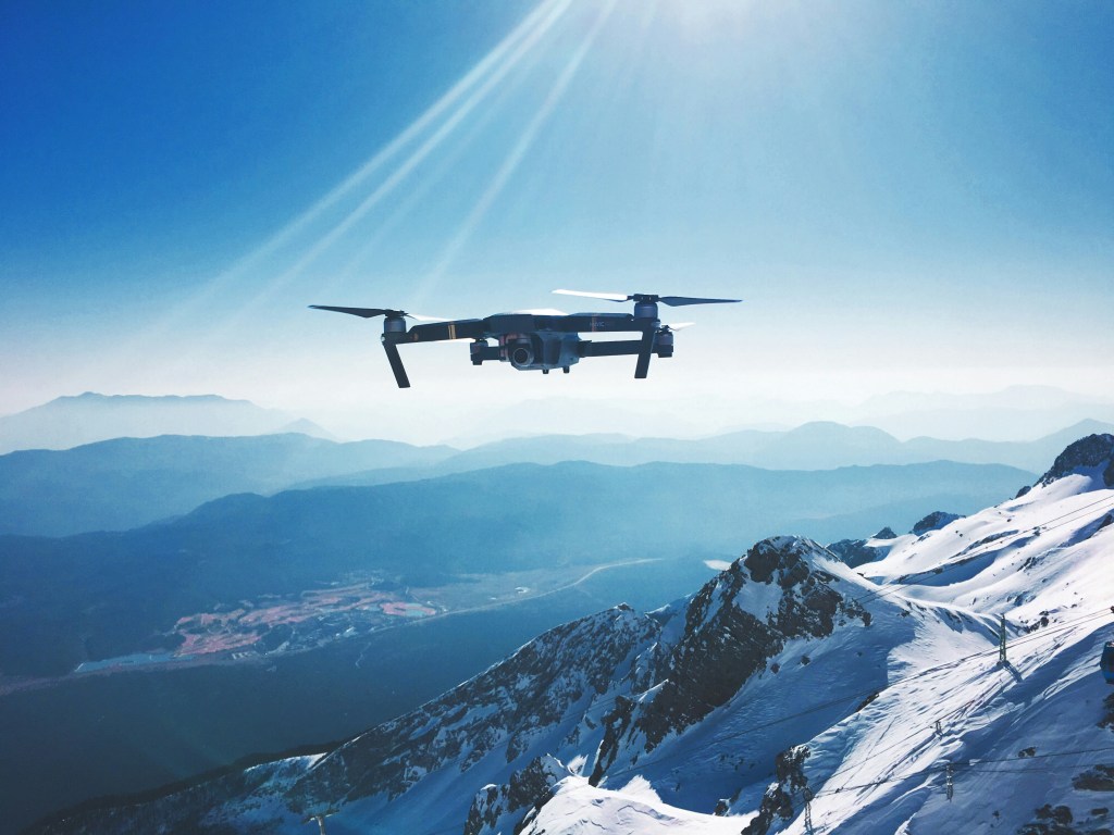
Drone Surveys
Property Aerial Marketing and Roof Surveys
Estate agents
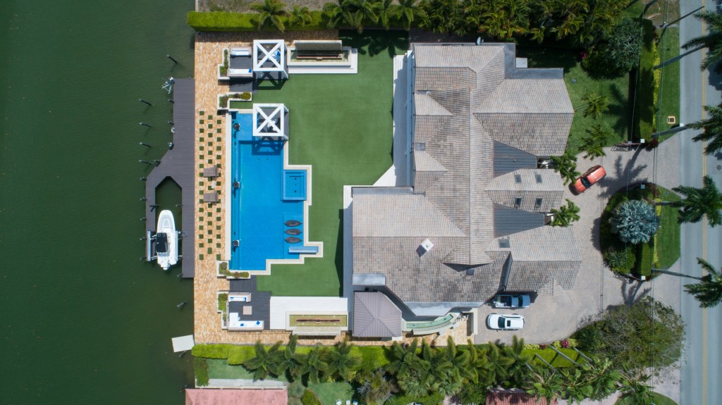
Elevate Your Property Listings with Stunning Aerial Imagery
In today’s competitive property market, standing out is essential. Our professional drone photography and video services provide estate agents with high-quality, aerial visuals that captivate potential buyers and showcase properties in the best light. Whether it’s residential, commercial, or luxury real estate, we deliver breathtaking aerial shots that drive interest and engagement.
1. Aerial Photography
Capture stunning high-resolution images that highlight a property’s surroundings, layout, and unique features. Ideal for residential and commercial property listings.
2. Aerial Video Tours
Engage buyers with smooth, cinematic footage that offers a real sense of the property’s scale and location. We create professionally edited videos with transitions, branding, and music.
3. Virtual Property Tours
Take property marketing to the next level with 360-degree drone tours, giving buyers an interactive viewing experience from anywhere.
4. Estate agents using aerial photography and drone video see a significant increase in buyer engagement and property inquiries. Aerial footage provides a more compelling and complete view of a property, making listings more attractive and shareable.
Contact us today for a free consultation and let’s take your marketing to new heights!
Book a Drone Photography Session Today!
Drone Roof Surveys
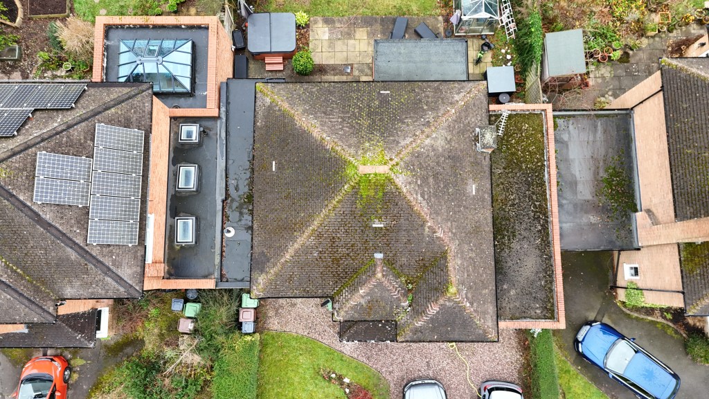
Fast, Safe & Accurate Aerial Roof Inspections and Surveys
Traditional roof inspections can be costly, time-consuming, and risky. Our drone-powered roof surveys provide a safer, faster, and more cost-effective solution for inspecting residential, commercial, and industrial properties. Using high-resolution aerial photography and video, we deliver detailed roof assessments without the need for scaffolding, ladders, or cherry pickers.
1. Aerial Roof Photography
Get crystal-clear aerial images of your roof to identify potential damage, wear and tear, or blocked gutters.
2. 4K Drone Video Inspections
Our drones provide live-feed and recorded video for real-time roof condition assessment. Ideal for contractors, surveyors, and property managers.
3. Thermal Imaging Roof Surveys
Detect heat loss, insulation issues, and hidden water damage with advanced thermal drone technology. Essential for energy efficiency evaluations and leak detection.
4. Commercial & Industrial Roof Inspections
We provide drone surveys for warehouses, office buildings, retail spaces, and large industrial sites, offering a cost-effective alternative to manual inspections.
5. Storm & Insurance Damage Assessments
Quickly assess storm damage, document issues for insurance claims, and get the necessary evidence for repairs and quotes.
Book a Drone Roof Inspection and Survey Today!
Drone Land Surveying

Professional Drone Land Survey & Mapping Services
Drone technology is transforming the way land surveys and mapping are conducted. Our professional drone land survey services provide high-precision aerial data for developers, construction companies, landowners, and environmental agencies. We deliver detailed topographic maps, 3D models, and high-resolution orthomosaic imagery to support your project.
1. Topographic & Land Mapping
We provide high-resolution aerial maps for land development, urban planning, and site analysis, ensuring accurate elevation and terrain data.
2. Construction Site Surveys
Monitor progress with real-time aerial imagery, track earthworks, and generate 3D site models to improve efficiency and project planning.
3. 3D Modelling & Digital Elevation Models (DEM/DSM)
Create detailed 3D terrain models for planning, environmental assessments, and volumetric calculations.
4. Volumetric Analysis & Stockpile Measurements
Quickly measure material stockpiles, cut-and-fill volumes, and site changes with precision for quarries, mines, and construction sites.
5. Agricultural & Environmental Surveys
Assess crop health, soil conditions, and forestry management with aerial imaging and multispectral analysis.
Contact us Today to Discuss Your Project Requirements!
About Us
At Astute Drone Surveys, we are passionate about leveraging cutting-edge drone technology to provide accurate, reliable, and efficient aerial surveying solutions. Our team consists of CAA-certified drone pilots and experienced survey professionals, committed to delivering high-quality data to support your projects. Whether you need, real estate drone photography, roof inspections, topographic mapping, volumetric analysis, or construction site monitoring, we tailor our services to meet your specific requirements.
We take pride in offering cost-effective, safe, and environmentally friendly alternatives to traditional land surveying methods. With a strong focus on precision, efficiency, and client satisfaction, we work closely with developers, engineers, and landowners across the UK to provide actionable insights that drive successful project outcomes.

Contact
Astute Drone Surveys
Head Office Address: Astute Ecology, Oakhurst House, 57 Ashbourne Rd, Derby, DE22 3FS.
Email: info@astutedronesurveys.co.uk
Phone: Please request a call back if you wish to discuss your project over the phone.
Your message has been sent

Frequently Asked Questions About Drone Surveys
Real Estate / Property Drone Photography
Q:Where can you fly drones? A:Drone operations must always comply with CAA regulations, including obtaining the necessary permissions and adhering to no-fly zones or restricted airspaces. We manage all legal requirements on behalf of our clients and provide pre-flight paperwork, including risk assessments and method statements (RAMs), where required, for every flight.
Q: How can drone photography benefit real estate / property marketing?
A: Drone photography provides stunning aerial views of properties, showcasing landscapes, proximity to amenities, and overall size. This helps attract buyers by offering a unique perspective that traditional photography cannot capture.
Q: Are drone photos and videos legal for real estate use?
A: Yes! We operate with full CAA certification, ensuring compliance with all UK aviation laws. We have a range of drones, including smaller drones with a low weight and size category allowing us to get closer to properties than the larger drones.
Q: How long does a real estate drone shoot take?
A: Typically, a standard property shoot takes between 30 minutes to an hour, depending on the size and complexity of the location.
Drone Roof Inspections & Surveys
Q: Why should I use drones for roof inspections instead of traditional methods?
A: Drone inspections are safer, faster, and more cost-effective than manual roof inspections. There’s no need for scaffolding or ladders, reducing risk and disruption while providing high-resolution imagery.
Q: What kind of damage can a drone detect?
A: Drones can detect cracked tiles, leaks, weather damage, blocked gutters, missing slates, and structural issues using photographs and video footage.
Q: Can I get a report after the survey?
A: Yes! We provide a comprehensive report including high-resolution images you can use to obtain quotes from multiple repair providers. We also provide links to view video footage.
Q: Can you quote for roof repairs?
A: Although we highlight recorded issues with roofs and associated areas, we do not currently have a roof maintenance department and therefore you would need to obtain your own quotes using the footage recorded. This allows you to contact multiple companies rather than being tied into the one who has installed scaffolding to check the roof initially.